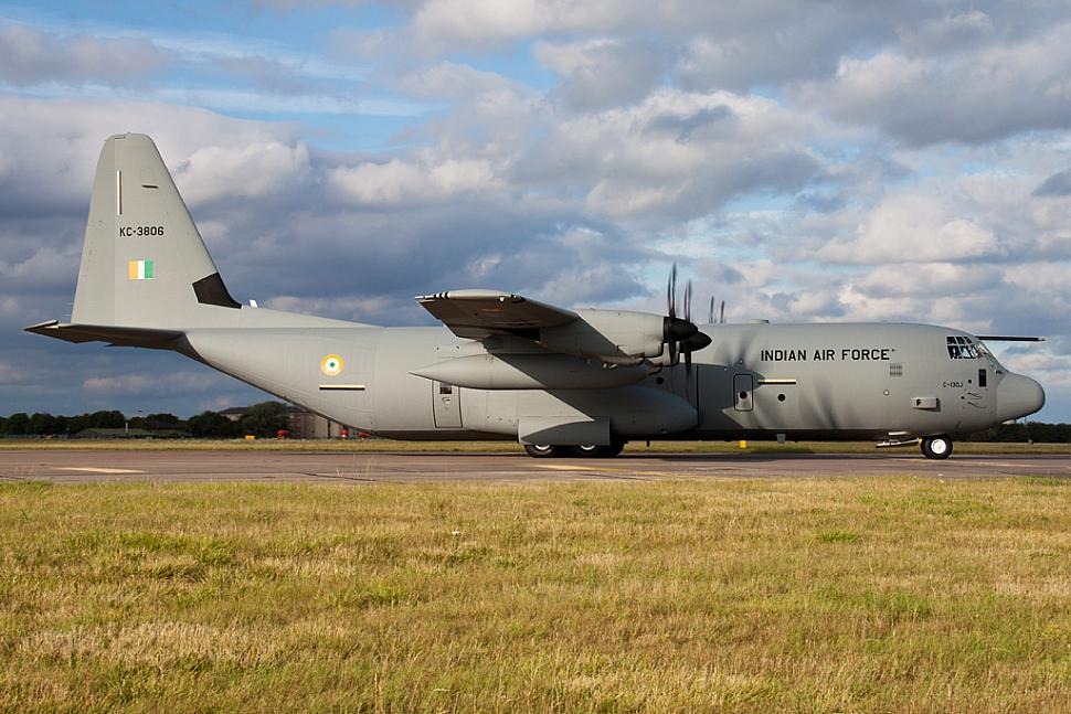
 An Indian Air Force C-130 J Hercules transport aircraft. (Photo: IAF)
New Delhi: The Indian Air Force’s C-130J Hercules and C-17 transport aircraft carrying humanitarian aid supplies to earthquake-hit Myanmar faced “GPS spoofing”, according to reports from credible sources. The incident has triggered security concerns as the IAF pilots were forced to rely on the backup systems, sources in the Ministry of Defence said on the condition of anonymity.
They said the spoofing changed real-time coordinates and misled the transport planes’ navigation system mid-flight. The sources also said that the pilots immediately switched to the internal navigation system (INS) to ensure safe navigation.
The incident first happened on March 29, according to the sources, when India sent the first consignment of relief materials to Southeast Asian nation in a C-130J aircraft. The C-130J pilots had reported that the plane’s GPS signals were tampered with when it was in Myanmar’s airspace. Later, IAF deployed C-17 Globemaster III transport aircraft to carry relief aid. Its pilots too reported similar GPS spoofing.
On March 28, Myanmar struck with a powerful 7.7-magnitude earthquake, which led to death of 3,649 people and injured over 5,000 others. Over a hundred aftershocks followed soon after. The tremors were felt in neighbouring Thailand and northeastern India.
After devastating earthquake in Myanmar, India launched Operation Brahma on 29 March, deploying IAF C-130Js & C-17s for swift humanitarian aid. But relief soon met resistance not from terrain, but cyber attacks & GPS spoofing.
— kaps78 (@sanjeev__kapoor) April 14, 2025
Here’s the untold story... As Indian aircraft…
India immediately launched a humanitarian assistance and disaster management (HADR) operation codenamed “Operation Brahma” in those two countries, as reported by India Sentinels. As part of the operation, New Delhi sent a total of six military transport aircraft to Myanmar transporting relief materials, field hospitals and rescue teams and a majority of them experienced GPS spoofing.
What is GPS Spoofing?
GPS spoofing of aircraft refers to a cyberattack technique where false GPS signals are broadcast to deceive an aircraft’s navigation system into thinking it’s in a different location than it actually is.
In simpler terms, aircraft rely heavily on the United States’ GPS (Global Positioning System) for navigation, route planning and landing approaches. If someone spoofs the GPS signals, the aircraft’s systems receive fake location data, which could lead pilots or autopilot systems to steer off course. In worst-case scenarios, it can result in airspace violations, near misses or grounding of flights.
The mechanics of GPS spoofing involve an attacker transmitting fake GPS signals that mimic real ones. These signals are usually stronger than genuine satellite signals. The aircraft’s receiver picks up the fake data and believes it’s real. Consequently, the system calculates the aircraft’s position based on the spoofed signals – thus showing a false location.
What makes this particularly dangerous is the flight safety risk, as aircraft may unknowingly fly into restricted or hostile airspace.
Navigation errors become especially risky during approach and landing. There's also potential for hijacking or disruption, not physically, but by deceiving where an aircraft thinks it is.
Several real-world examples highlight this threat. Iran, in 2011, allegedly used GPS spoofing to bring down a US RQ-170 drone. According to a report published by the OPSGROUP in September 2024, the first series of GPS spoofing was identified in September 2023 in the area of northern Iraq, centred on Baghdad.
Indian aircraft has been GPS-spoofed regularly. Similar spoofing incidents have occurred near the India-Pakistan border. Until now, more than 465 cases have been reported near Amritsar and Jammu since November 2023, according to available reports.
In recent years, there have been multiple reports of aircraft over the Black Sea, Middle East and parts of Asia experiencing spoofing incidents. Commercial airlines and cargo planes have reported GPS anomalies suspected to be caused by spoofing.
Countermeasures Against GPS Spoofing in Aircraft
Aircraft employ several sophisticated countermeasures to protect against GPS spoofing. Multi-sensor navigation is a primary defence, where aircraft cross-check GPS with inertial navigation systems (INS), which use gyroscopes and accelerometers. When discrepancies emerge between these systems, warnings can be triggered, alerting pilots to potential spoofing attempts.
Receiver autonomous integrity monitoring (RAIM) and its advanced counterpart ARAIM provide another layer of protection by detecting inconsistencies in satellite signals. These systems continuously monitor the integrity of GPS data and can identify when signals appear suspicious or contradictory.
Anti-spoofing antennas represent a hardware-based solution, as directional antennas can identify and reject signals coming from suspicious angles or sources. This helps filter out spoofed signals that typically originate from ground-based locations rather than satellites.
For military aircraft, encrypted GPS signals known as M-code provide enhanced security. These military-grade systems employ sophisticated encryption techniques that make spoofing attempts considerably more difficult to execute successfully.
Software algorithms further strengthen defences by using artificial intelligence (AI) or rule-based logic to flag unrealistic position changes or speeds. These intelligent systems can recognize patterns that might indicate spoofing and alert pilots accordingly.
Ground-based monitoring complements airborne systems, with air-traffic control or ground stations capable of detecting spoofing patterns and alerting aircraft in the affected area. This collaborative approach creates a more comprehensive defence network.
When pilots suspect they are experiencing GPS spoofing, several immediate actions can be taken. They might switch to alternative navigation systems such as INS or VOR/DME, which operate independently of GPS. If near an airport, pilots can rely on visual navigation techniques. It’s also critical for pilots to report suspected incidents to air-traffic control for confirmation of their actual location.
Finally, logging and sharing these incidents allows for thorough analysis and the creation of safety bulletins to help protect other aircraft.